Water
Our Rivers, Our Responsibility
In Yellowstone Country, water is more than a resource — it's a lifeline. Some of the nation's most iconic rivers begin here — the Madison, Gallatin, Yellowstone, Stillwater, Rock Creek and Clark's Fork.
We are down to the last river…The Yellowstone is worth saving if only to show what a free river looks like. — Jim Pozewitz, Life Magazine, 1978
The Yellowstone is the Lower 48's longest free-flowing river — no dams, just the rhythm of a river that still calls the shots.
Where Our Water Comes From
Our region's water system starts in the mountains. Winter snowpack is our natural reservoir. As snow melts, it flows through forests, grasslands and towns — feeding rivers, recharging groundwater and supporting everything from wildlife to agriculture.
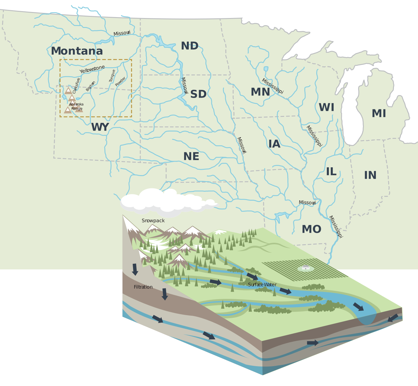
Watersheds + River Health
A watershed is an area of land that drains into a common waterway. Yellowstone Country includes the Yellowstone River watershed, approximately 45 million acres, and the Gallatin watershed, approximately 1.2 million acres.
Riparian Areas: The Streamside Buffer
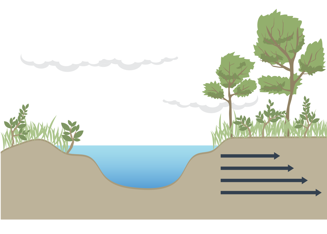
Riparian areas are the lush strips of vegetation that line rivers, streams and wetlands. These zones play a critical role in:
- Filtering pollutants before they reach the water
- Preventing erosion by holding soil in place
- Providing wildlife habitat and shade for fish
- Storing water like a sponge during dry months
When we build too close to rivers or strip away vegetation, we disrupt the river's ability to flood and move — consequences ripple through the entire ecosystem.
Healthy vs. Unhealthy Rivers
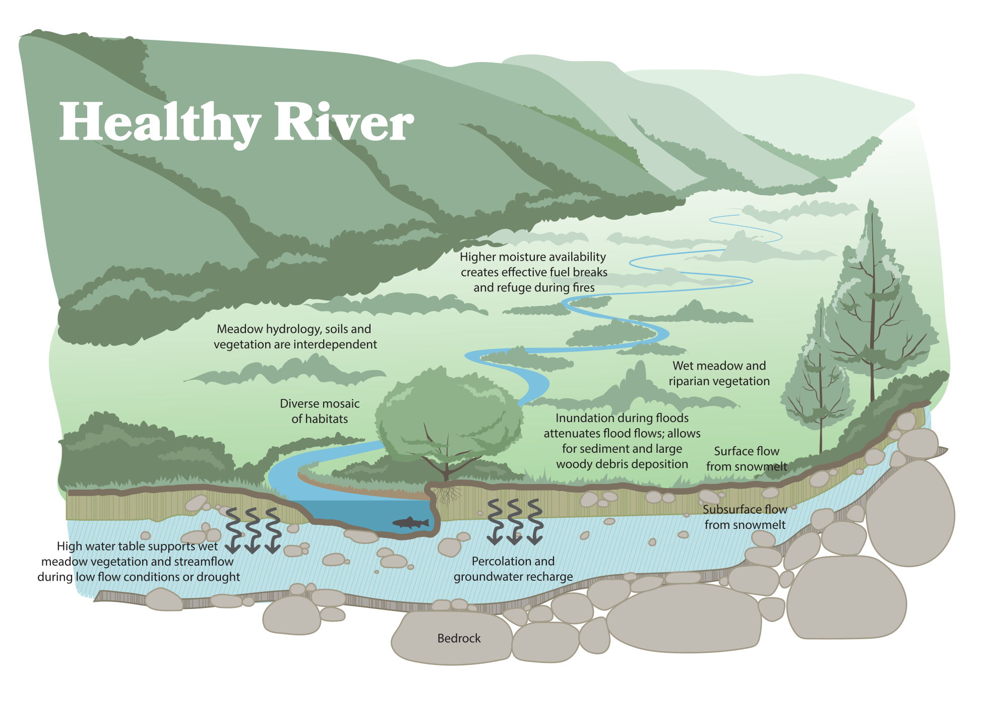
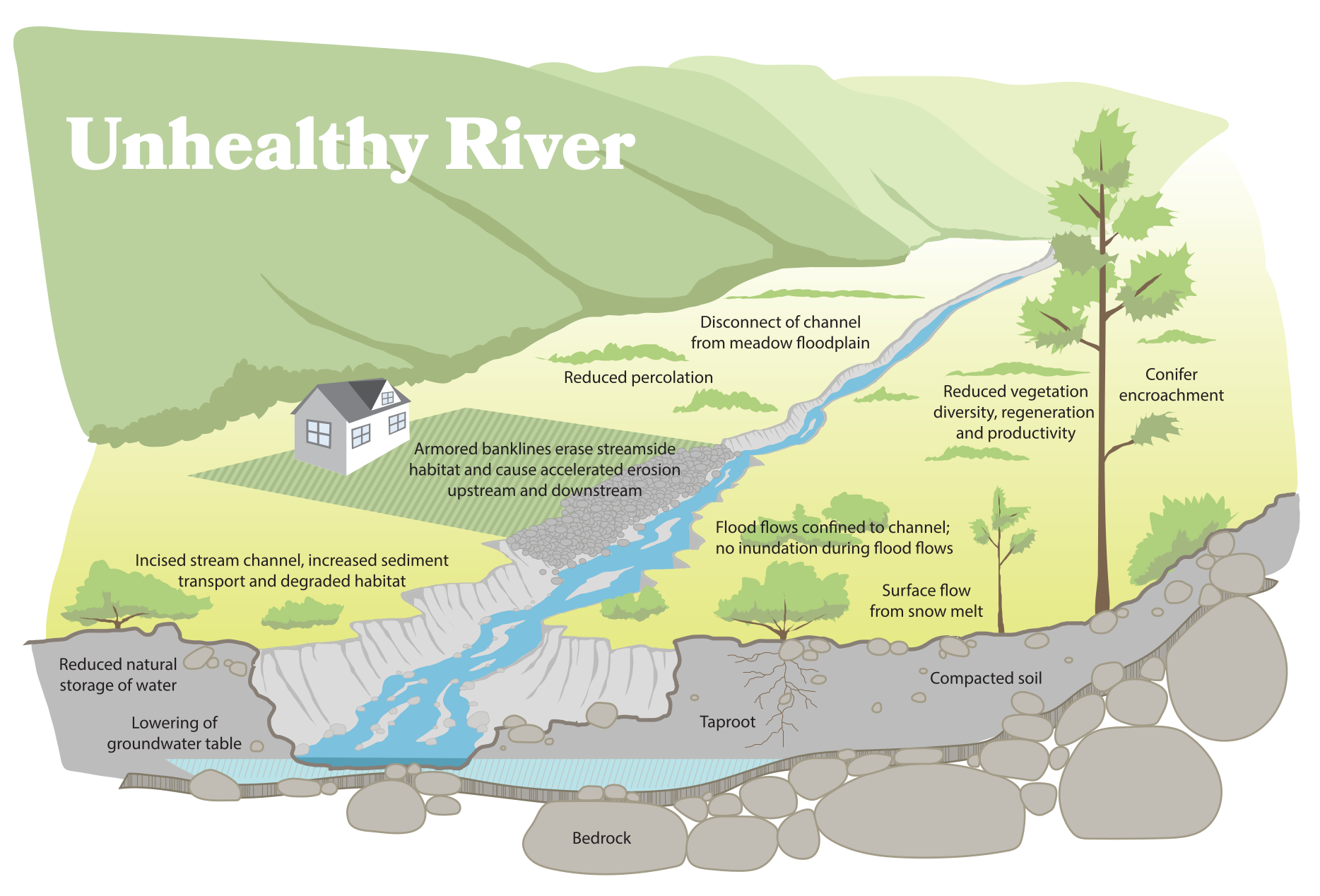
Rivers are meant to move. When they flow naturally, they support vibrant ecosystems, recharge groundwater and regulate temperatures.
| Healthy River | Unhealthy River |
|---|---|
| Connects to its floodplain | Cut off from its floodplain |
| Releases and stores water during spring runoff | Can't spread or slow down high flows |
| Keeps cool in summer — riparian shade | Erodes banks, worsens downstream flooding |
| Supports year-round fish and wildlife habitat | Heats up in summer, harming cold-water species |
Floodplains + Development
Why Do Streams Need Space?
Flooding isn't a failure — it's part of how rivers work. Building in the wrong places puts homes, roads and people in harm's way.
Key Terms
- Floodplain — flat areas next to rivers that absorb floodwaters
- Channel Migration Zones — areas where rivers naturally shift over time
- Avulsion Hazard Zones — areas where a river may suddenly change direction
- Erosion Hazard Zones — areas where riverbanks are likely to erode
If you live in one of these zones, your home is more likely to be damaged by flooding and erosion than by fire over a 30-year mortgage.
River Setback Guidelines
| Stream Size | Minimum Setback |
|---|---|
| Larger Rivers | 300 feet |
| Medium Streams | 150 feet |
| Small Streams | 100 feet |
Common Permits
- 310 Permit (County Conservation District) — stream bed/bank work
- 401 Certification (MT DEQ) — water quality impacts
- 404 Permit (U.S. Army Corps) — wetland or stream fill
- County Floodplain Permit — building in 100-year floodplain
- Montana Stream Permitting Handbook
After the Flood
Floods are part of Montana's natural cycle. After a flood, it's tempting to "fix" the river with heavy equipment. But clearing large wood or armoring banklines can do more harm than good.
Actions You Can Take
- Let rivers reconnect with their floodplains
- Maintain wide, vegetated riparian buffers
- Avoid concrete, riprap or hard surfaces near water
- Clear culverts and size them properly
- Use native plants with deep roots to stabilize soil
FOR HOMEOWNERS
- Direct stormwater runoff away from rivers
- Keep pet waste out of waterways
- Use fertilizers sparingly
- Service your septic system regularly
AGRICULTURAL BEST PRACTICES
- Fence livestock away from streams
- Use off-stream water sources
- Practice rotational grazing
- Maintain riparian buffers
Riparian Buffer Width Guide
| Width | Benefit |
|---|---|
| 30-50 ft | Provides shade, cools stream temps |
| 100 ft | Filters most sediment |
| 150 ft | Filters nutrients and pollutants |
| 200-300 ft | Supports wildlife, prevents erosion |